About the Route
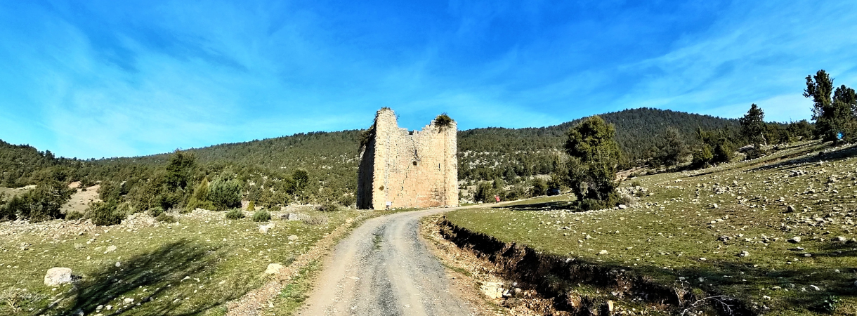
This route, located in the highlands of the Taurus Mountains at an altitude of 800 to 1,300 meters, offers a hike of approximately 25.2 km. The trail winds through quiet forest paths lined with juniper and cedar trees. Passing through Efeler Village, you cross the Kenzin Pass and then reach Fakılar Village. Sinap Castle can be seen while passing through Sığır Plateau. This stage, which reaches Çamlıyayla, has a moderate difficulty level.
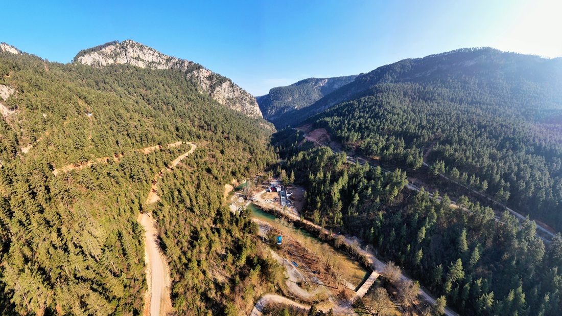
Starting from Çamlıyayla and passing through Sebil Village to Cehennem Creek National Park, this approximately 17 km long hike is of moderate difficulty. The path winds through tall trees and offers spectacular views of the canyon at the end. It is a very suitable area for camping.
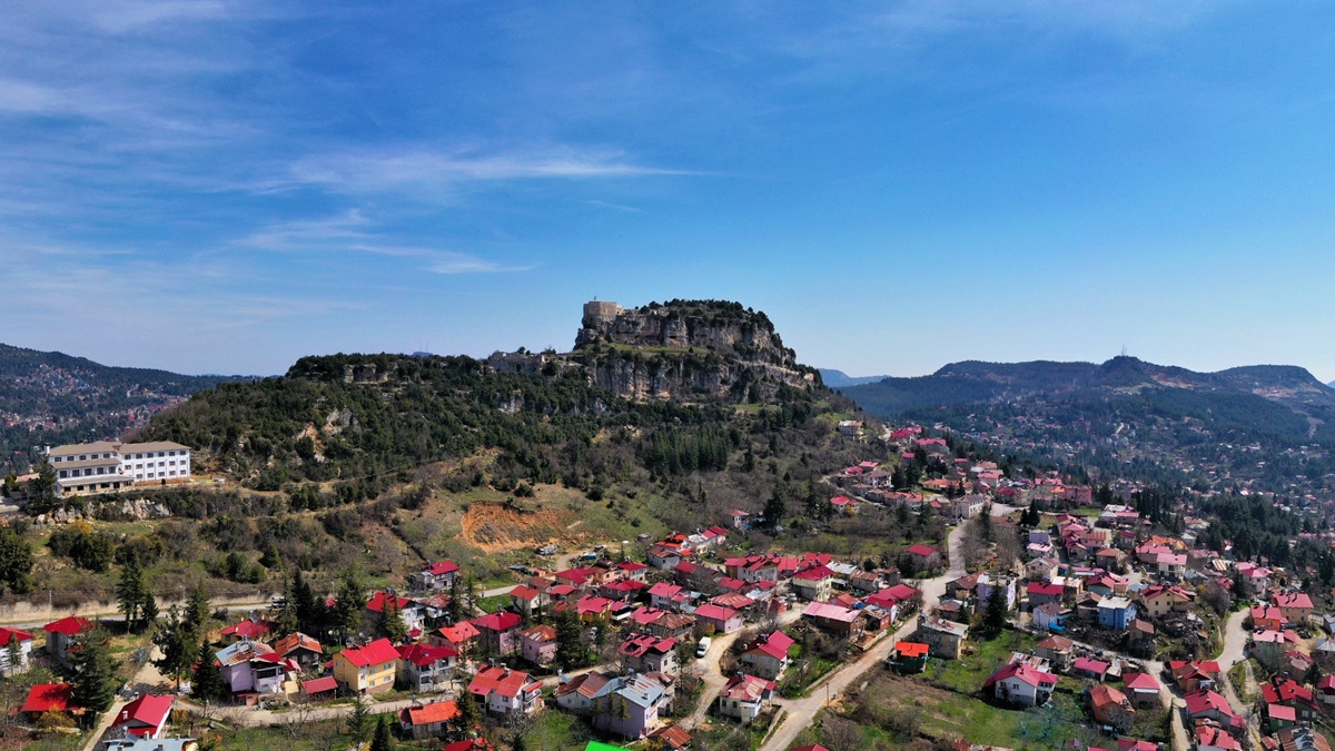
The walking path stretching from the Cehennem Creek Valley to Sadiye (Atlılar) Village, located at an altitude of 1,400 meters, covers a distance of 20.8 kilometers. This section, which requires a long and demanding climb, is considered one of the most challenging hiking routes. Sadiye (Atlılar) is a village settled by Circassians of Caucasian origin, renowned for the longevity of its residents.
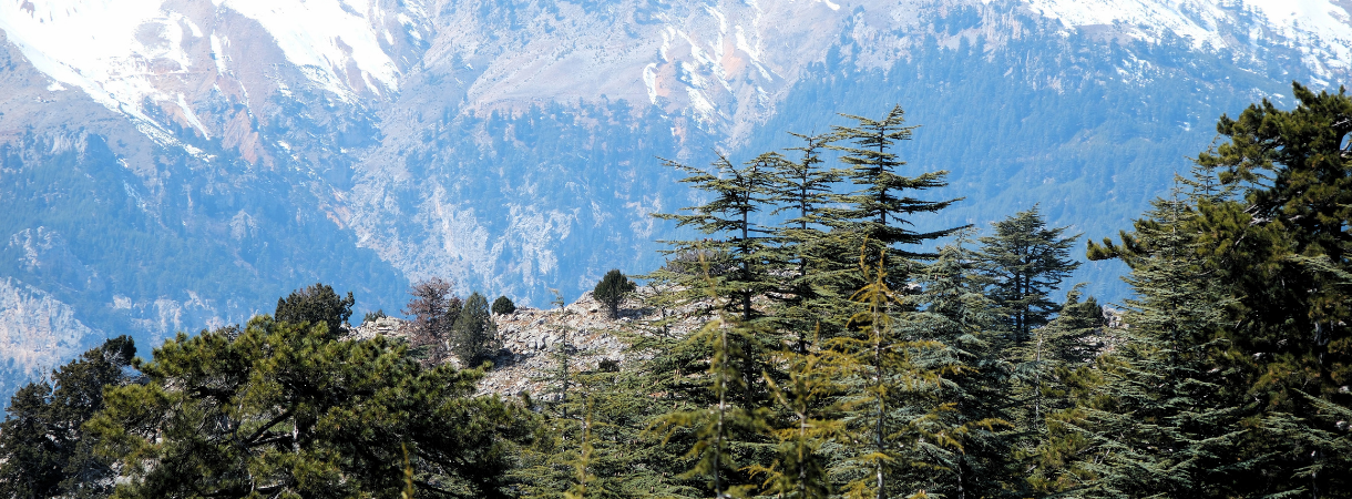
Starting from Sadiye (Atlılar) Village, the trail ascends for approximately 16.4 km to reach Değnek Pond at an altitude of 2,250 meters. Walking along historic caravan and migration routes, hikers can see impressive examples of cedar and juniper trees. The path runs through the wild nature of the Bolkar Mountains and is considered to be of ‘moderate to difficult’ paths.
This 12 km path descends from Değnek Pond at 2,250 meters to Değnek Village at 1,350 meters and is generally rated as easy due to its downhill nature. The route concludes with striking views as you pass through a canyon lined with juniper and cedar trees.
The 18.3 km long path stretching from the villages of Değnek and Tırtar to Arslanköy is of moderate difficulty. The path runs at an altitude of 1,400-1,800 meters and passes through the historic Dümbelek Pass. During the War of Independence, Arslanköy served as a crucial center of resistance and a key site where the Nationalist Forces received vital support.
Starting from Arslanköy, the hiking route, which mostly runs through juniper and cedar forests, is approximately 23.4 km long. The historic Baspınar fountain can be seen along the path, which rises to an altitude of 2000 meters. Due to the length of the route, camping is required.
Starting from Büyükkaya Hill, this 15.6 km route winds mostly through forested terrain and leads to Toros Village, offering an ideal opportunity to explore the rich flora of juniper and cedar woodlands.
The 17.1 km long hike between the highland villages of Toros, Kuşluca, and Güzeloluk passes through juniper and cedar forests. It is recommended to hike during the summer months. Güzeloluk Plateau has been inhabited since ancient times and contains ruins from the Roman and Byzantine periods. During the Ottoman era, it was a summer retreat for Yoruk nomads and later became an important center of resistance during the War of Independence.
The hike ends at the bed of the Lamos (Limonlu) River, among the highland villages built on the plateau at the summit of the Taurus Mountains. This 16 km hike is of moderate difficulty and takes place in the forest. The Lamos River serves as a source of agricultural production and drinking water, while the Lamos Canyon is an important natural heritage site. The region is notable for its biological diversity and historical remains. Remains from the ancient Roman and Byzantine periods, such as aqueducts, rock tombs, and mills, can be explored. The canyon is an ideal destination for nature tourism and camping.
Route Features


Route Details
Route Stages
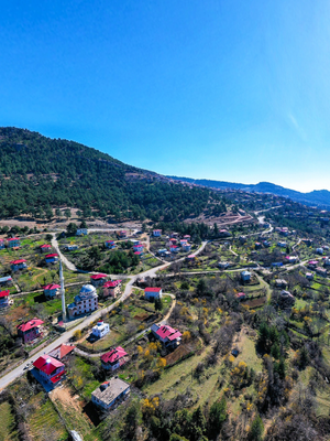
In Gülek Village at the foot of Gülek Castle, Gelgez Inn, one of the accommodation stations of the Silk Road, as well as a historical bridge and the route passing over the Roman Road, reach Ardıçlı Village. For general information about the inns in the region, please refer to the information on stage number 3.
The of this forested trail, where you will encounter the most tranquil states of nature, is , and it is possible to evaluate the
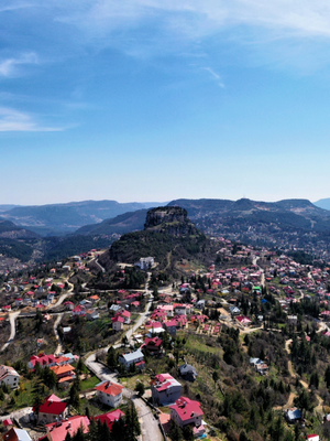
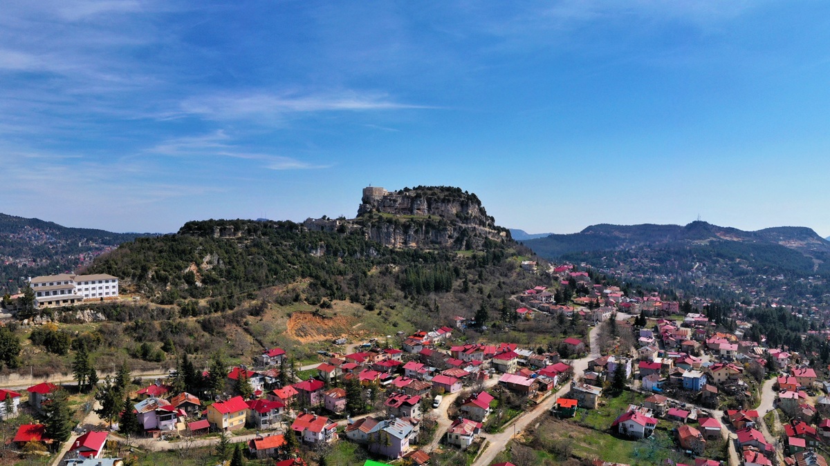
This route, which has an altitude range of approximately 800 to 1300 meters in the high parts of the Taurus Mountains, will cover approximately 25.2 km. Along the way, you will pass through quiet forest roads full of juniper and cedar trees, overcome the Kenzin Pass, one of the most magnificent canyons of the region, pass through Efeler Village, and reach Fakılar Village after a difficult climb. Pass through Sığır Plateau and see the imposing structure, which was the castle of one of the feudal lords in the Middle Ages and is now called Sinap Castle. Namrun Castle, which is also from the Middle Ages, is worth seeing on the stage, reaching Çamlıyayla (Namrun), the most populous district of the Taurus Mountains. The track, which will be walked in a very undulating geography, is one of the “” trails of the Cilicia Road.
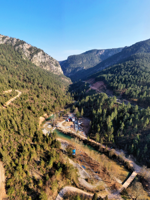
Starting from Çamlıyayla (Namrun) and extending to Cehennem Creek National Park via Sebil Village, this magnificent forest walk, which is , can be described as a trail of “” difficulty. However, the views encountered at the point reached are such as to make you forget the difficulty of the majestic canyon. It should be especially preferred to meet the privilege of camping in the forest consisting of trees growing at high altitude.
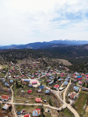
From the Cehennem Creek valley at 650 altitude, the village of Sadiye (Atlılar) at 1400 altitude will be reached. A long and tiring ramp awaits the hikers. Therefore, this forest walk can be defined as one of the With a 12 km climb, the total distance to be covered on this pleasant trail, where cardio can be measured, is . Being one of the longest trails reinforces the degree of difficulty.
Sadiye (Atlılar) is a Circassian village where our citizens of Caucasian origin live. It is rumored that there are many people living in the settlement, whose old name is Sadiye, for 100 years.
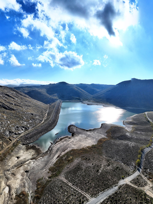
Approximately a will take you from Sadiye (Atlılar) Village at 1400 altitude to Degnek Pond at 2250 altitude. The vegetation, which becomes thinner as it rises, reveals landscapes where the naked and wild beauty of the Taurus Mountains can be seen. This historical road, which was used as a caravan and migration route on the Bolkars (Central Taurus Mountains), passes close to the monumental examples of cedar and juniper trees. The highest altitude points of the Cilicia Road will be reached at the pear area—Yılan Obası—Kanlı Saf locations. It is possible to enjoy the unique nature and take wonderful nature pictures, especially around the pond. The pond is also located at one of the highest altitude points of the Cilicia Road. Although the climbs are not heavy, there will be continuous ramps. Therefore, it is possible to define the track as a ‘ stage.
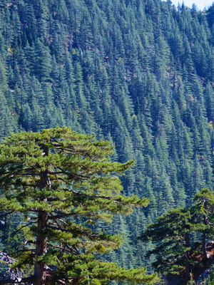
This route takes you from Degnek Pond, located at an altitude of 2,250 meters, down to Degnek Village at 1,350 meters. The trail, stretching from north to south, is primarily a descent and is considered one of the courses. Along the way, you’ll walk around the pond and pass through a spectacular canyon adorned with juniper and cedar trees, offering excellent opportunities to capture the beauty of the natural landscape.
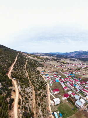
The reaching Arslanköy via Degnek and Tırtar villages is . On the route, which stretches at altitudes ranging between 1400 and 1800 m, there is the Dümbelek Strait (canyon), which is one of the passes connecting the Mediterranean to Central Anatolia and has been used since ancient times. Arslanköy, which is reached at the end of the course, is one of the most crowded plateaus of the Taurus Mountains. Formerly known as Efrenk, Arslanköy had a population of 2700 in 1947. The Efrenk Company, the most important defense unit of Mersin during the War of Independence, was also established in this village. Arslanköy had a strategic position as it was located at one of the important passes of the Taurus Mountains. While the French wanted to establish dominance in the Çukurova region they occupied, they also needed to break the resistance that emerged in the Taurus Mountains. However, Arslanköy became one of the important centers of the Kuvayi Milliye (nationalist forces) movement organized against the French, especially in Mersin and Tarsus. The local population put up a fierce resistance against the occupation, forming militia forces to defend their homeland. In 1920, the fighters of Arslanköy launched successful raids against French troops, slowing their advance into Mersin and Adana and boosting the morale of Turkish resistance forces. The people of Arslanköy demonstrated remarkable sacrifice during the War of Independence, both by providing vital logistical support and joining the armed struggle. A large part of the population actively supported the Kuvayı Milliye and ensured the defense of the region. In short, Arslanköy became one of the important points of resistance against the French in the War of Independence, especially in Çukurova and the Southern Front, and was in a position to shape the struggle in the region.
You will ascend to an altitude of approximately 2,000 meters along the track, which is mostly covered with juniper and cedar trees, as you walk on a caravan road through the forest. It is possible to see the historical Başpınar fountain 3.6 km south of the junction you will encounter on the route. This plateau trail on the Taurus Mountains takes you through a path in juniper and red pine forests, showcasing nature at its finest. It is also possible to define it as a track where Arslanköy Valley can be watched from the north. The length of the distance and the distance to modern roads should be taken into consideration. There is no settlement when Büyükkaya Hill is reached. It is also not possible to reach Toros Village on the same day. For this reason, camping is a necessity. Hikers should make preparations by considering all these details when choosing this trail and set off by taking at least two days' worth of supplies with them.
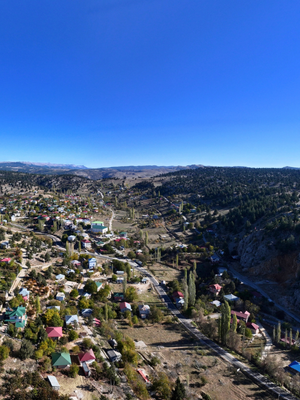
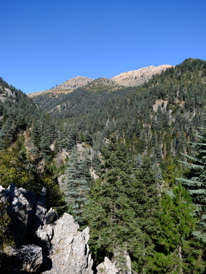
This trail passes through the mountain villages of Toros (Küçük Sorgun), Kuşluca, and Güzeloluk, winding through scenic juniper and cedar forests. Situated in the highlands of the Taurus Mountains, it is one of the region’s remarkable migration routes—ideal for summer hiking, as it becomes cold and snowy in winter.
The Güzeloluk Plateau and its surroundings have been settled since antiquity, with remnants from the Roman and Byzantine eras still visible in the area. In ancient times, the foothills of the Taurus Mountains served as important transit routes and strategic defense points.
During the Ottoman era, the Güzeloluk Plateau served as a summer residence for the nomadic Yoruk tribes. Evidence of Yörük culture remains visible on the plateau today. During the War of Independence, it became a key center of resistance against the French occupation. Like many other plateaus in the Taurus Mountains, it functioned as a base for the National Forces. The terrain of the plateau made it challenging for the French to move from the Taurus Mountains into the inland regions. The local people supported the national forces with supplies and fighters. Successful guerrilla tactics enabled resistance against the French. Today, the plateau is valued by the people of Erdemli and Mersin for its natural beauty and cultural significance. Festivals and events are held there to preserve the Yoruk culture.
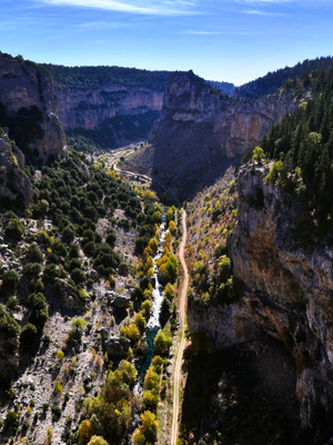
After trekking through the plateau villages nestled atop the Taurus Mountains, the trail leads down to the banks of the Lamos (Limonlu) River. This path, considered and passing partly through forested terrain, concludes with a memorable camping experience in a breathtaking natural setting.
The Lamos (Limonlu) River is vital not only as a source of drinking water and agricultural irrigation, but also because the canyon it flows through is recognized as a significant natural and cultural heritage site. Stretching from the Taurus Mountains to the Mediterranean coast, the canyon boasts dramatic cliffs, lush biodiversity, and historical richness. Visitors can observe karst-formed caves, waterfalls, and springs throughout the area. Situated where the Mediterranean climate meets mountainous terrain, the canyon supports a wide range of ecosystems. Its diverse wildlife includes mountain goats, birds of prey such as hawks and eagles, various reptiles, and wild boars.
Historically, the area around Lamos Canyon has been continuously inhabited since antiquity. Archaeological remains from the Roman and Byzantine periods—including aqueducts, rock-cut tombs, mills, and settlement traces—testify to its cultural importance. The riverbank was even used for prisoner exchanges between Arab and Byzantine forces during the Arab invasions of the 7th century AD.
Today, Lamos Canyon is a popular spot for outdoor activities like hiking, camping, and ecotourism. With its beautiful landscapes, it attracts photographers and nature enthusiasts alike. Especially during summer, the canyon serves as a refreshing retreat for locals seeking relief from the heat.
