About the Route
Route Features


Route Details
Route Stages
Tarsus- Dadallı- Kayadibi-Sağlıklı
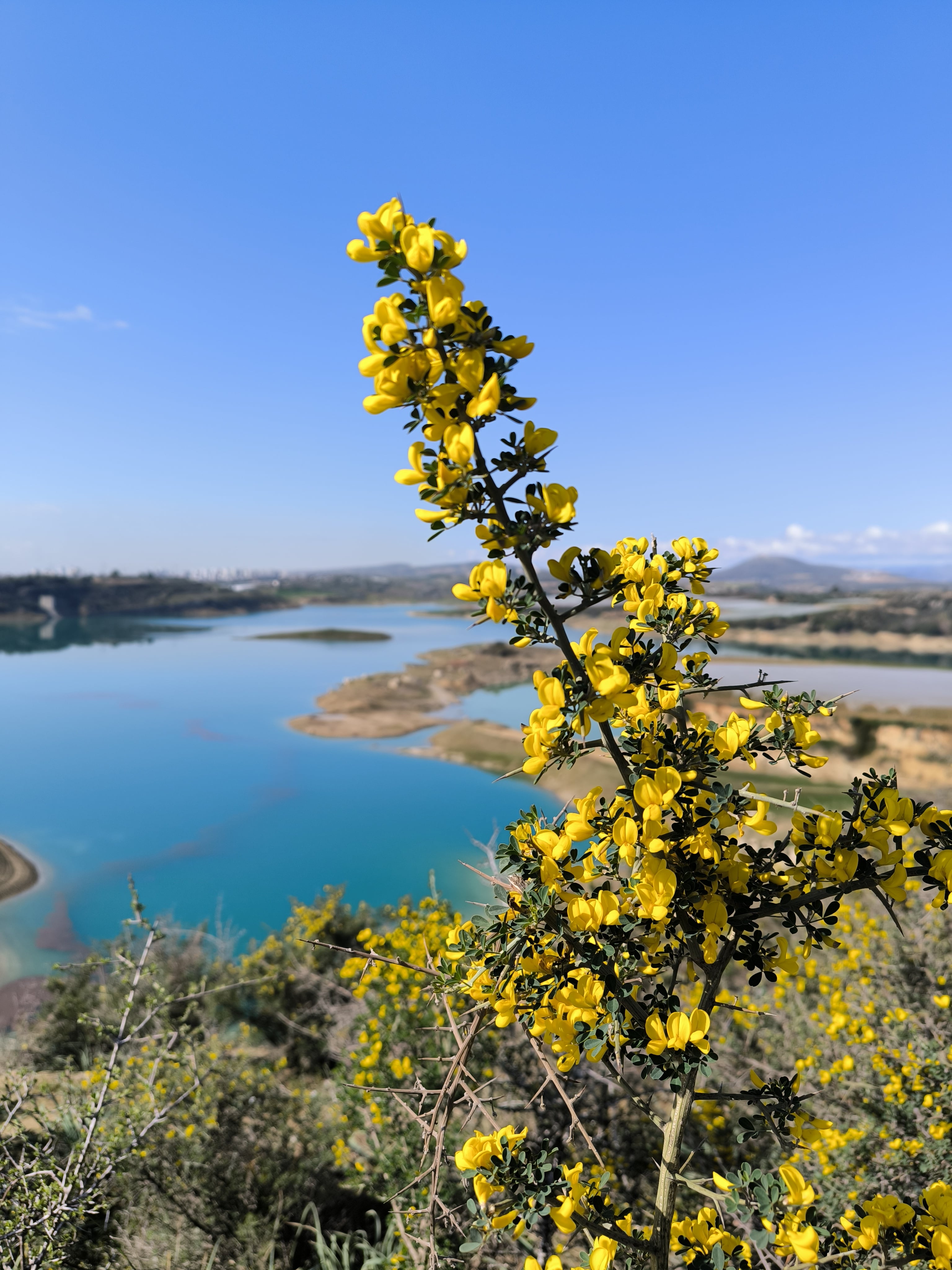
The Nature Park (Zoo), located 7 km north of Tarsus city centre, is the starting point of the first track. The journey, accompanied by the magnificent view of Berdan Dam Lake, passes through the borders of Dadalı and Kayadibi Villages and creates a complete therapeutic effect. Especially if it is experienced during spring months when nature comes alive, it will leave an indelible impression on your memory. This ends in the village of Sağlıklı. Since the 5-kilometer section of the stage between the Zoo and Dadallı Neighborhood is paved, it is recommended to start the hike along the shore of Berdan Reservoir in Dadallı Neighborhood.

Sağlıklı-Kızlar Castle (Çavuşlu)
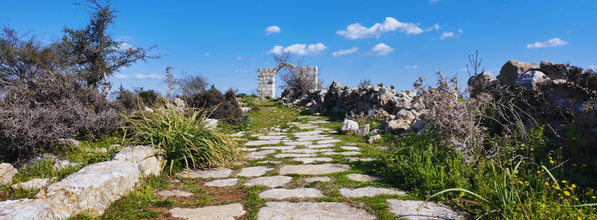
One of the best‑preserved Roman roads in Anatolia is found in the village of Sağlıklı. The first 3.5 km of this path can be walked along its magnificent stone pavement. This ancient road, which once connected Tarsus to Central Anatolia, can be traced in places to the vicinity of Kırıt Village. Rich in ruins from the Hellenistic, Roman, and Byzantine periods, Kırıt is one of the most significant ancient settlements in the hinterland of Tarsus.
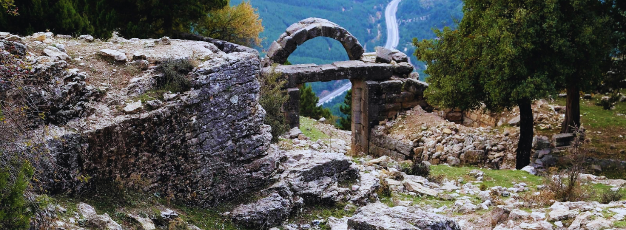
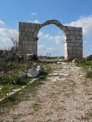
After Kırıt, you will pass to the east of the old Ankara Road and enter the route of the historical Silk Road; walking through fertile fields, you will reach the skirts of Kızlar Castle, one of the magnificent outposts of the Middle Ages. This magnificent structure was built to ensure the security of both the neighbourhood and the Silk Road. Starting from Sağlıklı and passing through the villages of Kırıt, Kadelli, Dörtler, Koçmarlı, the path ends at the foot of the Kızlar Castle near Çavuşlu Village.
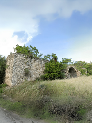
Kızlar Castle (Çavuşlu)-Sarışıh
On this path, which will be walked on the historical Silk Road, besides the Kızlar Castle, which provides the security of the road and remains from the Middle Ages, the historical Kuzoluk and Sarışıh Inns, which are also associated with the Silk Road, will be encountered.
Dated to the 16th century, Sarışıh Inn was originally identified as a menzil inn, which was associated with commercial activities, but is estimated to have been used for military purposes during the Iranian Campaigns of Suleyman the Magnificent and the Baghdad Campaigns of Murat IV. It is stated that menzil inns were used for trade in peace and military purposes during war. It is possible to make similar definitions for other inns in the region.
This walk, which will be carried out on the historical stone pavement in places, requires a slight climb depending on the altitude, if it is carried out from south to north. Considering that it is a long track of , it is possible to evaluate the .
Sarışıh-Gülek Castle
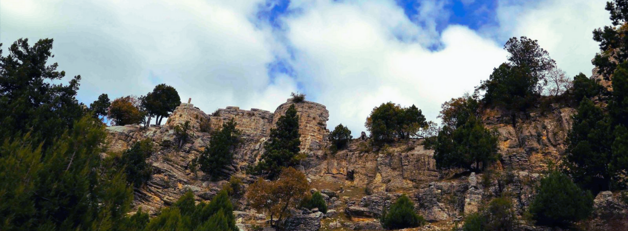
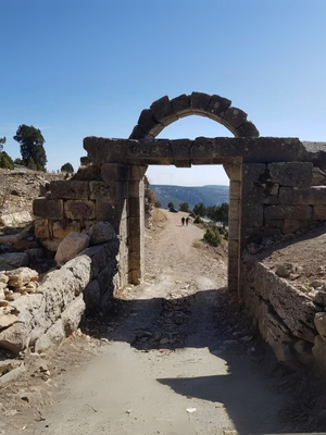
Starting from the historical Sarışıh Inn, the trail passes west of the highway and heads towards Gülek Castle via Çamalan Village, where the Turkish Martyrdom and the German Cemetery are located. Built in the Middle Ages, Gülek Castle has a magnificent location controlling the historical strait, known as the Cilician Gates (Cilicia Pylai), which connects the Cilicia Region to Central Anatolia.
It is reported (by Xenophon) that in the 4th century BC, a bullock cart passed through this strait, from which the eight-lane highway can now be watched from above. The Cilicia Gates, the most important gateway connecting Anatolia to the Mediterranean and the Middle East, was used by Alexander the Great, Persian kings, Roman emperors, and other great civilizations that left their mark in the past.
Gülek Castle also has extraordinary places where the most different photographs can be taken, and the Cliff Edge is the most special example of this. This spot, called Infinity Rock, is perhaps the only safe spot where you can take a picture on the edge of a cliff hundreds of meters high. , and the can be rated as The last part of the path, which has both the ascent and descent of Gülek Castle, can be described as “one of the difficult parts” of the Cilicia Road.